Exploring Top 10 Universities For Professional Land Surveyor Courses: Mapping Your Path To Success
Malaika M Khan
Last Updated: July 14, 2023
Jump to Section
Welcome, aspiring land surveyors! Are you ready to embark on a journey of precision, measurement, and spatial analysis? In this exciting blog, we will delve into the world of professional land surveying and discover the top universities and institutions that offer courses in this field. Whether you’re in India or looking to study abroad, we’ve got you covered. From program details to tuition costs, future prospects, and the impact of technology, we’ll explore it all in a fun and engaging manner. So, let’s grab our surveying equipment and get started!

Institutions Offering Courses For Professional Land Surveying
The Indian Institute Of Surveying And Mapping (IISM)
The Indian Institute of Surveying and Mapping (IISM) is a premier institution in India offering courses and programs in land surveying. With a strong focus on practical training and industry exposure, IISM equips students with the necessary skills and knowledge to excel in the field. The institute offers a range of courses, including diploma and degree programs, with a curriculum that covers various aspects of land surveying, mapping techniques, and geospatial technology. The tuition fees for these programs at IISM range from ₹50,000 to ₹2,00,000 depending on the duration and level of the course.
- Ranking: Notable ranking in India’s top surveying and mapping institutions.
- Accreditation: Accredited by the All India Council for Technical Education (AICTE).
- Intake: Limited seats available with a competitive admission process based on entrance exams and qualifying criteria.
- Challenges: Keeping up with the latest technological advancements and adapting to changing industry requirements.
- Benefits: Strong foundation in surveying and mapping principles, practical field experience, industry exposure, and networking opportunities.
- Entrance Exam: Admission based on the IISM Entrance Exam or national-level entrance exams like JEE Main or GATE.
The University Of California, Berkeley
The University of California, Berkeley, is renowned for its expertise in engineering and geospatial sciences. The university offers comprehensive programs in land surveying and geomatics, focusing on both theoretical knowledge and practical applications. Students at Berkeley gain hands-on experience with state-of-the-art surveying instruments and technologies. The tuition fees for land surveying programs at UC Berkeley vary depending on the degree level and residency status. For in-state students, the annual tuition fees range from approximately ₹20,00,000 to ₹25,00,000, while for out-of-state and international students, the fees range from ₹30,00,000 to ₹35,00,000.
- Ranking: Highly regarded as one of the top universities globally.
- Accreditation: Accredited by the Western Association of Schools and Colleges (WASC).
- Intake: Competitive admission process with a limited number of seats available.
- Challenges: Rigorous academic curriculum, high academic standards, and competitive environment.
- Benefits: Access to renowned faculty, state-of-the-art facilities, extensive research opportunities, and a strong alumni network.
- Entrance Exam: Admission based on SAT/ACT scores for undergraduate programs and GRE scores for graduate programs.
The Royal Melbourne Institute Of Technology (RMIT) University
RMIT University in Australia offers renowned programs in land surveying and geospatial sciences. The university has strong industry connections and provides students with practical training through fieldwork and industry placements. The curriculum covers a wide range of subjects, including land measurement, cadastral surveying, geodesy, and geographic information systems. The tuition fees for land surveying programs at RMIT University vary depending on the level of study. For undergraduate programs, the fees range from approximately ₹25,00,000 to ₹30,00,000 per year, while for postgraduate programs, the fees range from ₹30,00,000 to ₹35,00,000 per year.
- Ranking: Recognized as one of the top universities in Australia.
- Accreditation: Accredited by the Tertiary Education Quality and Standards Agency (TEQSA).
- Intake: Varies based on the program and course availability.
- Challenges: Balancing academic requirements with practical fieldwork, adapting to a multicultural learning environment.
- Benefits: Industry-focused education, strong industry connections, practical hands-on experience, and career development opportunities.
- Entrance Exam: Admission based on ATAR scores for undergraduate programs and IELTS/TOEFL scores for international students.
The University Of New South Wales (UNSW)
The University of New South Wales (UNSW) in Australia offers a comprehensive range of programs in land surveying and geospatial sciences. UNSW has a strong reputation for research and industry collaborations, providing students with opportunities to work on real-world projects. The curriculum covers areas such as cadastral surveying, photogrammetry, remote sensing, and land information management. The tuition fees for land surveying programs at UNSW vary depending on the program and level of study. For undergraduate programs, the fees range from approximately ₹25,00,000 to ₹30,00,000 per year, while for postgraduate programs, the fees range from ₹30,00,000 to ₹35,00,000 per year.
- Ranking: Highly ranked among Australian universities and globally recognized.
- Accreditation: Accredited by the Tertiary Education Quality and Standards Agency (TEQSA).
- Intake: Competitive admission process with limited seats available.
- Challenges: Academic rigour, adapting to a diverse learning environment, managing coursework and practical requirements.
- Benefits: Well-rounded education, extensive research opportunities, access to cutting-edge technology and facilities, industry connections.
- Entrance Exam: Admission based on ATAR scores for undergraduate programs and GAMSAT/GRE scores for specific graduate programs.
The University Of Alberta
The University of Alberta in Canada offers excellent programs in land surveying and geomatics engineering. The university focuses on practical training and experiential learning, allowing students to apply their knowledge in real-world settings. The curriculum covers areas such as geospatial data analysis, land administration, remote sensing, and geodetic surveying. The tuition fees for land surveying programs at the University of Alberta vary depending on the program and level of study. For undergraduate programs, the fees range from approximately ₹20,00,000 to ₹25,00,000 per year, while for postgraduate programs, the fees range from ₹25,00,000 to ₹30,00,000 per year.
- Ranking: Recognized as one of Canada’s top universities.
- Accreditation: Accredited by the Alberta Advanced Education.
- Intake: Limited seats available, competitive admission process.
- Challenges: Academic rigour, adapting to a challenging climate, managing coursework and practical components.
- Benefits: Strong technical education, research opportunities, industry collaborations, networking with professionals.
- Entrance Exam: Admission based on high school grades, SAT/ACT scores for international students, and specific program requirements.
The Technical University Of Munich (TUM)
The Technical University of Munich (TUM) in Germany is a leading institution offering programs in land surveying and geoinformation. TUM provides students with a strong theoretical foundation and practical training in state-of-the-art facilities. The curriculum covers subjects such as geodesy, remote sensing, cartography, and digital terrain modelling. The tuition fees for land surveying programs at TUM vary depending on the program and level of study. In Germany, most universities do not charge tuition fees for undergraduate programs, but students are required to pay a semester contribution of approximately ₹10,000 to ₹15,000. For postgraduate programs, tuition fees range from approximately ₹5,00,000 to ₹10,00,000 per year for international students.
- Ranking: One of Germany’s top technical universities with international recognition.
- Accreditation: Accredited by the German Council of Science and Humanities (Wissenschaftsrat).
- Intake: Limited seats available, competitive admission process.
- Challenges: Academic rigour, adjusting to a new cultural and academic environment, language proficiency requirements.
- Benefits: Strong technical and scientific education, research opportunities, industry collaborations, global networking.
- Entrance Exam: Admission based on high school grades, university entrance qualification exam (Abitur), and specific program requirements.
The University Of Nairobi
The University of Nairobi in Kenya offers comprehensive programs in land surveying and geospatial engineering. The university’s curriculum focuses on both theoretical knowledge and practical skills, providing students with a well-rounded education in the field. The tuition fees for land surveying programs at the University of Nairobi vary depending on the program and level of study. For undergraduate programs, the fees range from approximately ₹2,00,000 to ₹4,00,000 per year, while for postgraduate programs, the fees range from ₹3,00,000 to ₹6,00,000 per year.
- Ranking: One of Kenya’s top universities with a strong academic reputation.
- Accreditation: Accredited by the Commission for University Education (CUE).
- Intake: Varies based on the program and course availability.
- Challenges: Managing academic workload, adapting to a diverse student community, limited resources in some areas.
- Benefits: Quality education, exposure to a multicultural environment, networking opportunities, industry collaborations.
- Entrance Exam: Admission based on high school grades, university entrance exam, and specific program requirements.
The University Of Cape Town (UCT)
The University of Cape Town (UCT) in South Africa offers reputable programs in land surveying and geomatics. UCT provides students with a solid foundation in surveying principles, spatial data analysis, and geospatial technologies. The curriculum emphasises practical training and fieldwork to develop hands-on skills. The tuition fees for land surveying programs at UCT vary depending on the program and level of study. For undergraduate programs, the fees range from approximately ₹3,00,000 to ₹6,00,000 per year, while for postgraduate programs, the fees range from ₹4,00,000 to ₹8,00,000 per year.
- Ranking: Highly regarded as Africa’s leading university.
- Accreditation: Accredited by the Council on Higher Education (CHE).
- Intake: Limited seats available, competitive admission process.
- Challenges: Academic rigour, managing workload and extracurricular activities, adapting to a diverse campus.
- Benefits: High-quality education, research opportunities, access to renowned faculty, vibrant student life, international exposure.
- Entrance Exam: Admission based on high school grades, National Benchmark Test (NBT), and specific program requirements.
The University Of Otago
The University of Otago in New Zealand offers comprehensive programs in land surveying and geospatial science. The university combines theoretical knowledge with practical training, ensuring students develop a strong understanding of land surveying principles and techniques. The curriculum covers areas such as cadastral surveying, GIS, and remote sensing. The tuition fees for land surveying programs at the University of Otago vary depending on the program and level of study. For undergraduate programs, the fees range from approximately ₹20,00,000 to ₹25,00,000 per year, while for postgraduate programs, the fees range from ₹25,00,000 to ₹30,00,000 per year.
- Ranking: The University of Otago is consistently ranked among the top universities in New Zealand and is recognized internationally for its academic excellence.
- Accreditation: The university holds accreditation from the New Zealand Qualifications Authority (NZQA) and is a member of the Association of Commonwealth Universities (ACU).
- Intake: The university has two intakes per year, in February and July, for most programs.
- Challenges: Some challenges students may face include adjusting to a new academic environment, managing coursework, and adapting to a new culture if coming from abroad.
- Benefits: The University of Otago offers a high-quality education, excellent research opportunities, a vibrant campus life, and a supportive learning environment.
- Entrance Exam: Depending on the specific program, applicants may be required to submit standardised test scores or demonstrate English language proficiency.
The University Of Nottingham
The University of Nottingham in the United Kingdom offers comprehensive programs in land surveying and geospatial engineering. The university provides students with a solid foundation in surveying techniques, data analysis, and geospatial technologies. The curriculum covers areas such as land management, geodesy, photogrammetry, and GIS. The tuition fees for land surveying programs at the University of Nottingham vary depending on the program and level of study. For undergraduate programs, the fees range from approximately ₹25,00,000 to ₹30,00,000 per year, while for postgraduate programs, the fees range from ₹30,00,000 to ₹35,00,000 per year.
- Ranking: The University of Nottingham is a prestigious university ranked among the top universities in the UK and internationally.
- Accreditation: The university is accredited by the UK Quality Assurance Agency for Higher Education (QAA) and is a member of the Russell Group, a prestigious association of leading UK research universities.
- Intake: The university has multiple intakes per year, with specific programs offering different intake options.
- Challenges: Students may face challenges such as adapting to a new academic system, managing coursework, and adjusting to life in a new country if studying abroad.
- Benefits: The University of Nottingham offers a world-class education, state-of-the-art facilities, diverse cultural experiences, and excellent career prospects.
- Entrance Exam: The university may require applicants to submit standardised test scores, such as the SAT or ACT, for undergraduate programs, while postgraduate programs may require specific entrance exams or portfolio submissions.

Future Scope Of Professional Land Surveyor Field
Job Opportunities
Professional land surveyors have diverse job opportunities across various sectors. In the construction industry, they play a crucial role in site preparation, layout, and verification of building positions. In engineering projects, land surveyors contribute to the design and alignment of infrastructure, including roads, railways, and pipelines. They also support environmental assessment projects by mapping and monitoring land use and natural resources. Government agencies rely on land surveyors for land management, cadastral mapping, and property valuation. With the increasing demand for land development and urban planning, professionals in this field have a wide range of career options.
Infrastructure Development
As societies strive for sustainable and efficient infrastructure systems, professional land surveyors are indispensable. They provide accurate data for the planning and design of transportation networks, water and wastewater systems, and energy infrastructure. Land surveyors work closely with engineers and architects to ensure that projects comply with regulations and are environmentally responsible. With the global emphasis on infrastructure development and renewal, the demand for skilled land surveyors is expected to grow.
Real Estate And Property Management
Land surveyors play a vital role in the real estate sector, supporting property transactions and development. They conduct boundary surveys, establish property lines, and prepare legal descriptions. Surveyors also assist in land subdivision, land use planning, and mapping of easements and rights-of-way. With the booming real estate market and the need for accurate property assessments, professionals in this field have ample opportunities for growth and specialisation.
Land Development and Environmental Conservation
Professional land surveyors contribute to land development projects by conducting topographic surveys, analysing terrain characteristics, and assessing environmental impact. They help ensure that development activities comply with zoning regulations, protect natural resources, and mitigate potential hazards. Land surveyors also play a crucial role in conservation efforts, mapping protected areas, and monitoring land changes over time. With the increasing focus on sustainable land use practices and environmental conservation, professionals in this field have an important role to play.
Geographic Information Systems (GIS)
The integration of land surveying with GIS technology opens new avenues for professionals. Land surveyors skilled in GIS analysis and spatial modelling can support urban planning, disaster management, and resource management. They contribute to projects involving spatial data collection, analysis, and visualisation. With the growing importance of geospatial information in decision-making processes, land surveyors with GIS expertise are highly sought after.
The future career prospects for professional land surveyors are bright, driven by factors such as urbanisation, infrastructure development, and environmental concerns. Professionals who adapt to emerging technologies and gain expertise in areas like LiDAR, remote sensing, and data analysis will have a competitive edge in the job market. Additionally, continuous professional development, networking, and staying up to date with industry trends are essential for career advancement in this dynamic field.
Payscale At Various Levels
The payscale for professional land surveyors can vary based on factors such as experience, qualifications, geographic location, and the type of organisation they work for. Here is an overview of the average annual salaries at various levels in the field:
Entry-level: Entry-level land surveyors with limited experience typically earn an average annual salary ranging from ₹4,00,000 to ₹8,00,000. These positions often involve assisting senior surveyors, conducting field surveys, and performing basic data analysis.
Mid-level: As surveyors gain more experience and expertise, their salaries increase. Mid-level land surveyors with around 5-10 years of experience can earn an average annual salary ranging from ₹8,00,000 to ₹15,00,000. They are involved in more complex surveying projects, manage field teams, and contribute to data analysis and mapping.
Senior-level: Senior land surveyors with over 10 years of experience and advanced qualifications earn higher salaries. Their average annual income ranges from ₹15,00,000 to ₹30,00,000. Senior surveyors often oversee large-scale projects, provide technical guidance, and play a key role in decision-making related to surveying operations.
Consulting or managerial positions: Land surveyors who move into consulting or managerial roles can expect higher salaries. As they take on additional responsibilities such as project management, client relations, and business development, their average annual income can range from ₹30,00,000 to ₹50,00,000 or more.
Which Countries Have Growth Perspectives?
United States
The United States offers significant growth prospects for professional land surveyors. The demand for surveying and mapping services is driven by infrastructure development, urban planning, and land management. According to the Bureau of Labor Statistics, employment in the surveying and mapping field is projected to grow by 5% from 2020 to 2030, adding approximately 5,400 new jobs. The expansion of renewable energy projects, transportation networks, and construction activities further contributes to the demand for land surveyors. In terms of salary, the average annual income for land surveyors in the US ranges from ₹25,00,000 to ₹40,00,000, depending on factors such as experience, qualifications, and geographic location.
Canada
Canada also presents favourable growth opportunities for professional land surveyors. The country’s focus on infrastructure development and land management drives the demand for surveying services. The Surveying and Mapping Society of Canada predicts a positive job outlook for surveyors, with a steady increase in employment. Government initiatives and investments in transportation, renewable energy, and urban planning contribute to the demand for land surveyors. In terms of compensation, the average annual salary for land surveyors in Canada ranges from ₹20,00,000 to ₹35,00,000, depending on factors such as experience, qualifications, and location within the country.
Australia
Australia is experiencing steady growth in the land surveying sector. The country’s expanding population, urbanisation, and infrastructure development contribute to the demand for surveying services. The Australian Bureau of Statistics projects a 7.3% increase in employment for surveyors and spatial scientists from 2020 to 2024. This growth is driven by the need for accurate land mapping, land development projects, and urban planning. The average annual salary for land surveyors in Australia ranges from ₹30,00,000 to ₹50,00,000, depending on factors such as experience, qualifications, and location within the country.
India
In India, the land surveying profession is poised for growth due to rapid urbanisation, infrastructure development, and the government’s emphasis on digital mapping and land records modernization. The country’s ambitious projects such as Smart Cities, industrial corridors, and rural development initiatives drive the demand for land surveyors. The Indian Institute of Surveyors expects a significant increase in job opportunities for surveyors in the coming years. The average annual salary for land surveyors in India ranges from ₹8,00,000 to ₹20,00,000, depending on factors such as experience, qualifications, and location within the country.
United Kingdom
The land surveying sector in the United Kingdom shows promising growth prospects. The demand for surveying services arises from land development projects, infrastructure planning, and property management. The Royal Institution of Chartered Surveyors (RICS) anticipates increased demand for surveyors in areas such as land development, property management, and infrastructure projects. The UK’s commitment to infrastructure upgrades, including transport networks and renewable energy, further contributes to the demand for land surveyors. The average annual salary for land surveyors in the UK is around ₹25,00,000 to ₹40,00,000, depending on factors such as experience, qualifications, and geographic location.
How Is Technology And AI Impacting The Professional Land Surveyors Field?
Advanced Surveying Equipment
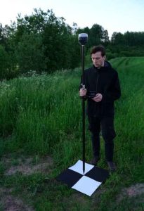
Technology has revolutionised surveying equipment, providing professionals with advanced tools such as GPS receivers, laser scanners, drones, and total stations. These instruments are equipped with high-precision sensors and imaging capabilities, allowing for accurate data collection and measurements. They enable surveyors to capture data more efficiently, reducing field time and improving overall survey accuracy. The integration of these technologies with surveying practices has transformed the way data is collected, enhancing productivity and providing a more comprehensive understanding of the surveyed areas.
Data Processing and Analysis
With the advent of technology and AI, data processing and analysis have become more streamlined and efficient. Advanced software and algorithms can handle large volumes of survey data, automatically processing and analysing it to extract valuable information. AI-powered tools can identify patterns, anomalies, and trends, enabling surveyors to derive meaningful insights from the collected data. This not only saves time but also improves the accuracy and quality of survey reports and maps. The use of AI in data analysis enhances decision-making processes and helps in identifying critical factors influencing land surveying projects.
Remote Monitoring and Real-time Data
Technology has facilitated remote monitoring and real-time data collection in the land surveying field. Remote sensing technologies, including satellite imagery and aerial surveys, provide surveyors with up-to-date information about land areas. AI algorithms can process this data in real-time, enabling surveyors to monitor changes, detect land deformations, and assess project progress remotely. Real-time data collection enhances project management, allows for quick decision-making, and reduces the need for frequent site visits. This capability is particularly beneficial for large-scale projects and those in remote or challenging locations.
Automated Mapping and 3D Modelling
Technology has simplified the mapping process for land surveyors through automation and 3D modelling. AI algorithms can analyse survey data and automatically generate accurate maps and 3D models of land areas. This streamlines the mapping workflow, reducing manual effort and potential errors. Automated mapping tools can identify features, boundaries, and contours from survey data, creating detailed visual representations of the surveyed areas. These 3D models and maps facilitate better visualisation, analysis, and design of land projects, improving communication among stakeholders and supporting informed decision-making.
Improved Safety and Efficiency
Technology has enhanced safety and efficiency in land surveying operations. For instance, the use of drones in surveying eliminates the need for surveyors to physically access hazardous or inaccessible areas. Drones equipped with cameras and sensors can capture data from aerial perspectives, improving safety and reducing risks to personnel. AI algorithms can analyse captured data to identify potential safety hazards, such as unstable terrain or construction site risks. This integration of technology and AI not only ensures a safer working environment but also enhances surveying efficiency, leading to cost savings and improved project timelines.
Integration with GIS and BIM
Technology has facilitated the integration of land surveying data with Geographic Information Systems (GIS) and Building Information Modeling (BIM) systems. By integrating survey data with these platforms, surveyors can collaborate seamlessly with professionals from various disciplines involved in land projects. GIS enables the visualisation and analysis of spatial data, enhancing decision-making and providing a comprehensive view of the surveyed areas. BIM systems allow for the integration of survey data with architectural, engineering, and construction data, facilitating better project coordination, clash detection, and design optimization. The integration of surveying data with GIS and BIM enhances project outcomes, minimises conflicts, and supports effective planning and design processes.

Become A Professional Land Surveyor With Mentoria!
Congratulations on exploring the top universities and institutions offering professional land surveyor courses! By choosing the right educational path, you are setting yourself up for an exciting and rewarding career. Remember to consider factors such as program curriculum, faculty expertise, and industry connections when making your decision. With the future scope, demand in various countries, and the integration of technology and AI, the field of land surveying holds immense potential. So, strap on your surveying gear and embark on a journey filled with accurate measurements, precise mapping, and a bright future ahead!
We’re here to provide you with all the help! Kick-start your journey with Mentoria and discover the right fit for you. Feel free to call us to speak to our career mentors and choose the right guidance plan that suits your needs.
Mentoria’s career guidance programme enables you to choose your perfect fit from 3 streams, 850+ courses, and 12,000+ careers, and discover what will bring out the best in you.